68,80 €*
Versandkostenfrei per Post / DHL
Lieferzeit 1-2 Wochen
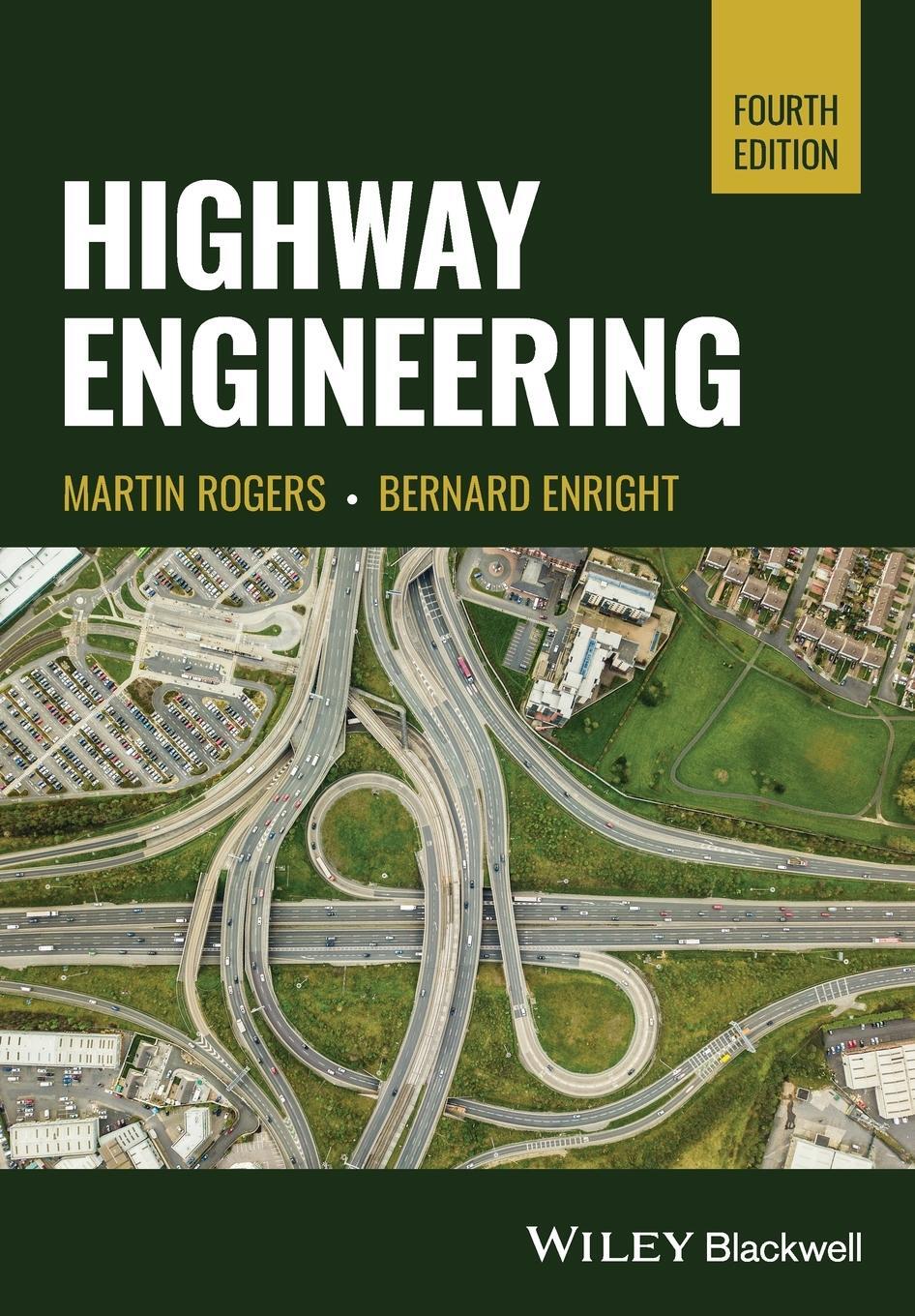
Understand a foundational area of civil engineering with this up-to-date textbook
Highway construction is a complex discipline within civil engineering, with the potential to transform national economies and transportation infrastructures. With car infrastructure coming under both increasing demand and increasing scrutiny for its environmental impact, the challenges and complexities of highway engineering have never been a more vital subject. The future of sustainable transportation depends on an engineering profession with a solid grasp of the fundamentals of highway design and construction.
Highway Engineering provides a comprehensive overview of these fundamentals, preparing civil engineers and engineering students to analyze, design, and build highways. Situating its subject in the context of a broader political economy, social and ecological reality, and more, it proceeds in a logical sequence from planning to design to construction to maintenance. The result is a fully up-to-date introduction to this subject at the heart of transport engineering.
Readers of the fourth edition of Highway Engineering will also find:
* Strong integration of material from the UK Design Manual for Roads and Bridges, incorporating recent significant changes in the design of highway pavements
* Detailed examples and case studies to cultivate deepened understanding
* Increased attention to the growing importance of non-car-based modes of highway transportation--walking, cycling and public transport.
Highway Engineering is essential for engineering students studying civil engineering or transport engineering, as well as for professional civil engineers looking for a reference work.
Martin Rogers, PhD, is a Transport Planning Practitioner and Senior Lecturer in the School of Transport and Civil Engineering, Technological University Dublin, Ireland. He is a Transport Planning Professional (TPS), a Chartered Civil Engineer (ICE) and Chartered Town Planner (RTPI), with extensive experience in both the private and public sectors, including membership in the Dublin Transport Initiative Study Team that devised the Dublin city region's first integrated transportation plan.
Bernard Enright, PhD, is a Lecturer in the School of Transport and Civil Engineering, Technological University Dublin, Ireland. He has considerable experience in the engineering and information technology industries and has published extensively on highway engineering and related subjects.
1 The Transportation Planning Process 1
1.1 Why Are Highways So Important? 1
1.2 The Administration of Highway Schemes 1
1.3 Sources of Funding 2
1.4 Highway Planning 3
1.4.1 Introduction 3
1.4.2 Travel Data 4
1.4.3 Highway Planning Strategies 6
1.4.3.1 Land-Use Transportation Approach 6
1.4.3.2 The Demand Management Approach 6
1.4.3.3 The Car-Centred Approach 7
1.4.3.4 The Public Transport-Centred Approach 7
1.4.4 Transportation Studies 7
1.4.4.1 Transportation Survey 7
1.4.4.2 Production and Use of Mathematical Models 8
1.5 The Decision-Making Process in Highway and Transport Planning 8
1.5.1 Introduction 8
1.5.2 Economic Assessment 10
1.5.3 Environmental Assessment 11
1.5.4 Public Consultation 12
1.6 Summary 13
References 13
2 Forecasting Future Traffic Flows 15
2.1 Basic Principles of Traffic Demand Analysis 15
2.2 Demand Modelling 16
2.3 Land-Use Models 18
2.4 Trip Generation 18
2.4.1 TRICS (r) Database 23
2.5 Trip Distribution 24
2.5.1 Introduction 24
2.5.2 The Gravity Model 25
2.5.3 Growth Factor Models 30
2.5.4 The Furness Method 31
2.6 Modal Split 36
2.7 Traffic Assignment 41
2.8 A Full Example of the Four-Stage Transportation Modelling Process 46
2.8.1 Trip Production 46
2.8.2 Trip Distribution 47
2.8.3 Modal Split 50
2.8.4 Trip Assignment 52
2.9 'Decide and Provide' Versus 'Predict and Provide' 53
2.10 Concluding Comments 54
Additional Problems 54
References 57
3 Scheme Appraisal for Highway Projects 59
3.1 Introduction 59
3.2 Economic Appraisal of Highway Schemes 60
3.3 Cba 61
3.3.1 Introduction 61
3.3.2 Identifying the Main Project Options 61
3.3.3 Identifying all Relevant Costs and Benefits 62
3.3.3.1 Reductions in VOCs 63
3.3.3.2 Savings in Time 63
3.3.3.3 Reduction in the Frequency of Accidents 64
3.3.4 Economic Life, Residual Value, and the Discount Rate 64
3.3.5 Use of Economic Indicators to Assess Basic Economic Viability 65
3.3.6 Highway CBA Worked Example 67
3.3.6.1 Introduction 67
3.3.6.2 Computation of Discounted Benefits and Costs 68
3.3.6.3 Npv 70
3.3.6.4 Benefit-Cost Ratio 70
3.3.6.5 Irr 70
3.3.6.6 Summary 70
3.3.7 Coba 70
3.3.8 Advantages and Disadvantages of CBA 71
3.4 Payback Analysis 73
3.5 Environmental Appraisal of Highway Schemes 75
3.6 The New Approach to Appraisal 80
3.6.1 Environment 81
3.6.1.1 Noise 81
3.6.1.2 Local Air Quality 81
3.6.1.3 Landscape 82
3.6.1.4 Biodiversity 82
3.6.1.5 Heritage 82
3.6.1.6 Water 82
3.6.1.7 Safety 83
3.6.1.8 Economy 83
3.6.1.9 Journey Times and VOCs 83
3.6.1.10 Costs 83
3.6.1.11 Reliability 83
3.6.1.12 Regeneration 83
3.6.1.13 Accessibility 84
3.6.1.14 Pedestrians, Cyclists, and Equestrians 84
3.6.1.15 Access to Public Transport 85
3.6.1.16 Community Severance 85
3.6.1.17 Integration 85
3.7 NATA Refresh 86
3.7.1 Changes to the AST 86
3.7.2 Enhanced Presentation of Monetary Impacts 87
3.7.3 More Detailed Relationship Between Benefit-Cost Ratio and Value for Money 87
3.8 Transport Analysis Guidance: The Transport Appraisal Process 87
3.9 Project Management Guidelines 89
3.10 Common Appraisal Framework for Transport Projects and Programmes 90
3.11 Summary 91
References 91
4 Basic Elements of Highway Traffic Analysis 93
4.1 Introduction 93
4.2 Surveying Road Traffic 93
4.2.1 Introduction 93
4.2.2 Vehicle Surveys 94
4.2.2.1 Introduction 94
4.2.2.2 Manual Counts 94
4.2.2.3 Automatic Counts 94
4.2.3 Speed Surveys 95
4.2.4 Delay/Queuing Surveys 96
4.2.5 Area-Wide Surveys 96
4.2.5.1 Introduction 96
4.2.5.2 Roadside Interview Surveys 97
4.2.5.3 Self-Completion Forms 97
4.2.5.4 Registration Plate Surveys 97
4.3 Journey Speed and Travel Time Surveys 98
4.3.1 Introduction 98
4.3.2 The Moving Observer Method 98
4.4 Speed, Flow, and Density of a Stream of Traffic 103
4.4.1 Speed-Density Relationship 103
4.4.2 Flow-Density Relationship 104
4.4.3 Speed-Flow Relationship 105
4.5 Headway Distributions in Highway Traffic Flow 109
4.5.1 Introduction 109
4.5.2 Negative Exponential Headway Distribution 110
4.5.3 Limitations of the Poisson System for Modelling Headway 114
4.6 Queuing Analysis 114
4.6.1 Introduction 114
4.6.2 The D/D/1 Queuing Model 114
4.6.3 The M/D/1 Queuing Model 118
4.6.4 The M/M/1 Queuing Model 119
4.6.5 The M/M/N Queuing Model 120
Additional Problems 123
References 128
5 Determining the Capacity of a Highway 129
5.1 Introduction 129
5.2 The 'Level of Service' Approach Using the Transportation Research Board 129
5.2.1 Introduction 129
5.2.2 Some Definitions 131
5.2.3 Maximum Service Flow Rates for Multilane Highways 131
5.2.4 Maximum Service Flow Rates for Two-Lane Highways 137
5.2.5 Sizing a Road Using the Highway Capacity Manual Approach 140
5.3 The 2010 Highway Capacity Manual - Analysis of Capacity and Level of Service for Multi-Lane and Two-Lane Highways 143
5.3.1 Introduction 143
5.3.2 Capacity and Level of Service of Multilane Highways (2010 Highway Capacity Manual) 143
5.3.2.1 Flow Characteristics Under Base Conditions 143
5.3.2.2 Capacity of Multilane Highway Segments 144
5.3.2.3 Level of Service (LOS) for Multilane Highway Segments 144
5.3.2.4 Required Data for the LOS Computation 144
5.3.2.5 Computing LOS for a Multilane Highway 145
5.3.3 Capacity and Level of Service of Two-Lane Highways 150
5.3.3.1 Flow Characteristics Under Base Conditions 150
5.3.3.2 Capacity and Level of Service 150
5.3.3.3 Required Input Data and Default Values 151
5.3.3.4 Demand Volumes and Flow Rates 152
5.3.3.5 Computing LOS and Capacity for a Two-Lane Highway 152
5.3.3.6 Determining Level of Service for Class 1 Two-Lane Highways 154
5.3.3.7 Determining the Level of Service for Class 2 Two-Lane Highways 161
5.3.3.8 Determining the Level of service for Class 3 Two-Lane Highways 166
5.4 The 2016 Highway Capacity Manual - Analysis of Capacity and Level of Service for Multi-Lane Highways 167
5.4.1 Introduction 167
5.4.2 Capacity and Level of Service of Multilane Highways (2016 Highway Capacity Manual) 167
5.4.2.1 Speed Versus Flow 167
5.4.2.2 Baseline Conditions and Capacity 167
5.4.2.3 Determining Free-Flow Speed 168
5.4.2.4 Determination of Incident Flow Rate 168
5.4.2.5 Calculation of Density and Determination of Level of Service 168
5.5 The UK Approach for Rural Roads 170
5.5.1 Introduction 170
5.5.2 Estimation of AADT for a Rural Road in Its Year of Opening 171
5.6 The UK Approach to Urban Roads 173
5.6.1 Introduction 173
5.6.2 Forecast Flows on Urban Roads 174
5.7 Expansion of 12- and 16-Hour Traffic Counts into AADT Flows 177
5.8 Concluding Comments 178
Additional Problems 179
References 181
6 The Design of Highway Intersections 183
6.1 Introduction 183
6.2 Deriving DRFs from Baseline Traffic Figures 184
6.2.1 Existing Junctions 184
6.2.2 New Junctions 184
6.2.3 Short-Term Variations in Flow 184
6.2.4 Conversion of AADT to Highest Hourly Flows 185
6.3 Major/Minor Priority Intersections 185
6.3.1 Introduction 185
6.3.2 Equations for Determining Capacities and Delays 189
6.3.3 Geometric Layout Details 196
6.3.3.1 Horizontal Alignment 196
6.3.3.2 Vertical Alignment 196
6.3.3.3 Visibility 196
6.3.3.4 Dedicated Lane on the Major Road for Right-Turning Vehicles 196
6.4 Roundabout Intersections 197
6.4.1 Introduction 197
6.4.2 Types of a Roundabout 199
6.4.2.1 Mini-Roundabout 199
6.4.2.2 Normal Roundabout 200
6.4.2.3 Double Roundabout 200
6.4.2.4 Other Forms 201
6.4.3 Traffic Capacity at Roundabouts 203
6.4.3.1 Drf 205
6.4.4 Geometric Details 209
6.4.4.1 Entry Width 209
6.4.4.2 Entry Angle 209
6.4.4.3 Entry Radius 209
6.4.4.4 Entry Deflection/Entry Path Radius 210
6.4.4.5 Icd 210
6.4.4.6 Circulatory Carriageway 210
6.4.4.7 Main Central Island 210
6.5 Basics of Traffic Signal Control: Optimisation and Delays 210
6.5.1 Introduction 210
6.5.2 Phasing at a Signalised Intersection 212
6.5.3 Saturation Flow 212
6.5.4 Effective Green Time 217
6.5.5 Optimum Cycle Time 217
6.5.6 Average Vehicle Delays at the Approach to a Signalised Intersection 220
6.5.7 Average Queue Lengths at the Approach to a Signalised Intersection 222
6.5.8 Signal Linkage 223
6.6 Concluding Remarks 228
Additional Problems 228
References 230
7 Geometric Alignment and Design 233
7.1 Basic Physical Elements of a Highway 233
7.1.1 Main Carriageway 233
7.1.2 Central Reservation 233
7.1.3 Hard Shoulders/Hard Strips/Verges 234
7.2 Design Speed and Stopping and Overtaking Sight Distances 237
7.2.1 Introduction 237
7.2.2 Urban Roads 238
7.2.3 Rural Roads 239
7.2.3.1 Statutory Constraint 239
7.2.3.2 Layout Constraint 239
7.2.3.3 Alignment Constraint 240
7.2.3.4 New/Upgraded Rural Roads 242
7.3 Geometric Parameters Dependent on Design Speed 244
7.4 Sight Distances 244
7.4.1 Introduction 244
7.4.2 Stopping Sight Distance 245
7.4.3 Overtaking Sight Distance 246
7.5 Horizontal Alignment 248
7.5.1 General 248
7.5.2 Deriving the Minimum Radius Equation 248
7.5.3 Horizontal Curves and Sight Distances 251
7.5.3.1 Alternative Method for Computing Ms 253
7.5.4 Transitions 254
7.5.4.1 Shift 255
7.6 Vertical Alignment 258
7.6.1 General 258
7.6.2 K Values 259
7.6.3 Visibility and Comfort Criteria 260
7.6.4 Parabolic Formula 260
7.6.5 Crossfalls 263
7.6.6 Vertical Crest Curve Design and Sight Distance Requirements 264
7.6.6.1 Derivation of Crest Curve Formulae 265
7.6.7 Vertical Sag Curve Design and Sight Distance Requirements 269
7.6.7.1 Driver Comfort 269
7.6.7.2 Clearance from Structures 269
7.6.7.3 Sag Curves in Night-Time Conditions 270
Additional Problems 271
References 274
8 Highway Pavement Materials 275
8.1 Introduction 275
8.2 Pavement Components: Terminology 275
8.3 Soils at Subformation Level 279
8.4 Materials in Foundations 279
8.5 Materials in Flexible Pavements 280
8.5.1 Bitumen 280
8.5.2 Asphalt Concrete (Coated Macadams) 281
8.5.3 Hot Rolled Asphalt 282
8.5.4 Aggregates 282
8.5.5 Designation of Asphalt Materials...
| Erscheinungsjahr: | 2023 |
|---|---|
| Fachbereich: | Bau- und Umwelttechnik |
| Genre: | Technik |
| Rubrik: | Naturwissenschaften & Technik |
| Medium: | Taschenbuch |
| Seiten: | 448 |
| Inhalt: | 448 S. |
| ISBN-13: | 9781119883302 |
| ISBN-10: | 111988330X |
| Sprache: | Englisch |
| Einband: | Kartoniert / Broschiert |
| Autor: |
Enright, Bernard
Rogers, Martin |
| Hersteller: | John Wiley and Sons Ltd |
| Maße: | 244 x 170 x 24 mm |
| Von/Mit: | Bernard Enright (u. a.) |
| Erscheinungsdatum: | 03.08.2023 |
| Gewicht: | 0,771 kg |

